Introduction:
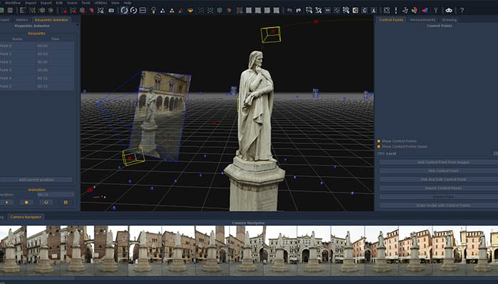
Photogrammetry is a powerful tool used in surveying and mapping that utilizes photographs to create accurate 3D models of terrain and objects. With the use of photogrammetry software, surveyors and cartographers can create detailed maps, models, and measurements that are essential in a variety of industries, including mining, construction, and land management. In this article, we will explore the benefits of using photogrammetry software in surveying and mapping.
Accurate and Detailed Measurements
Photogrammetry software can generate highly accurate and detailed measurements of terrain and objects. By analyzing a series of overlapping photographs, the software can create a 3D model that can be measured to obtain precise dimensions and distances. This level of accuracy is particularly useful in industries such as mining and construction, where precise measurements are essential to ensuring safety and efficiency.
Increased Efficiency and Cost Savings
Photogrammetry software can also significantly increase efficiency and cost savings in surveying and mapping. Traditional surveying methods require a significant amount of time and resources to complete. However, with the use of photogrammetry software, surveyors can quickly capture a large amount of data, reducing the time and cost associated with traditional surveying methods.
Improved Visualization and Collaboration
Another benefit of using photogrammetry software is improved visualization and collaboration. By creating detailed 3D models, surveyors and cartographers can provide a more immersive and realistic view of terrain and objects. This can be particularly useful in the planning and design phase of construction projects, allowing stakeholders to visualize the project in greater detail. Additionally, the ability to share 3D models with stakeholders can improve collaboration and communication, reducing the risk of errors and misunderstandings.
Conclusion:
In conclusion, photogrammetry software is a powerful tool that can significantly improve the accuracy, efficiency, and collaboration in surveying and mapping. By utilizing this technology, professionals in various industries can create more detailed and accurate 3D models, leading to better decision-making and cost savings.

No comments yet