Surveyor land survey is the technique, profession, and science of measuring the shape of the land and gathering data for civil engineering and construction projects. The land surveying profession is called a land survey. A surveyor is a professional person with academic qualifications and technical expertise in land surveying. Surveyors guide construction and development projects & provide the information needed for property purchase and sale.
LAND SURVEYING
Land surveying involves measuring and determining property boundaries, which are used as the basis for all property transactions, including buying, selling, mortgaging, and leasing.
DGPS
Technical assessment of DGPS survey land survey is an important part of the Land Survey service group. The survey services provided by the Land Survey Service cover all aspects of the survey profession. These include ground control surveys for photogrammetric projects, airborne GPS, differential GPS, route and alignment surveys, boundary and cadastral surveys, monitoring projects for structural movements, surveys in hazardous environmental conditions, mineral surveys, construction and cross-accuracy, and DGS. Department Surveys. As a customer-oriented organization, the Ground Survey Service's combination of survey staff, equipment, and PC resources allows tailoring of the project approach to meet all project accuracy and precision requirements. The Land Survey Service has developed innovative methods for collecting field survey data, which will accelerate its post-processing in the workplace. These innovative methods are called our survey methodologies.
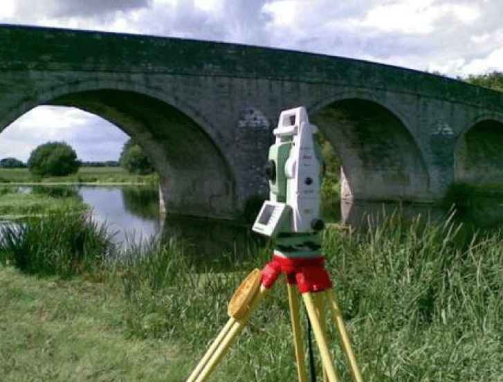
TOPOGRAPHY
Topographic surveys are an engineering process used to map the surface of the earth. Boundary surveys focus on horizontal measurements, while topographic surveys focus on landforms and elevations. In topographic surveys, most of the measurements are done with a surveying quality global positioning system (GPS) unit and electronic distance measurements of total station theodolite. The result of the survey is presented in the form of contour lines on maps of the land these maps are then used for land planning construction mining and agriculture.
ALTA/ACSM SURVEY
The ALTA Survey is a boundary survey prepared jointly by ALTA/ACSM and set to the set of minimum standards approved. A complex survey product designed to assist all parties involved in a commercial real estate transaction. In addition, the ALTA survey shows improvements, facilities, rights-path, and other factors affecting land ownership.
BOUNDARY SURVEY
A Boundary survey is an important part of pre-construction care. The boundary survey determines the perimeter of the property concerning the legal interpretation of the site.
Read More: https://www.leenusindia.com/survey-design/

No comments yet