Geomatics essentially refers to all the technologies which are used in collecting, storing, analyzing, and distributing the data collected.
The term is grossly overused and sometimes even wrongly. With so many technologies working together towards a single goal, it becomes important to understand what these technologies are and how to aid surveyors and consultants in providing a good result.
These technologies are being used and updated at each stage, which is further expediting the areas of applications for geomatics technologies. Here are some geomatics technologies and their applications.
Understanding Different Geomatics Technologies
Any geomatics technology focuses on technologies, products, and services involved in gathering, analyzing, and managing data. Here are several geomatics technologies:
1. Geodesy and geomatics: Geodesy acts as an integral part of geomatics. Geodesy helps determine the size and nature of the earth mathematically.
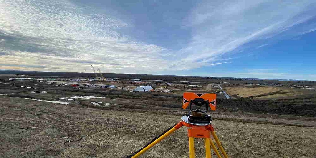
2. Surveying: Land surveyors use satellites, Sonar, 3D scanning, and even drones to measure, analyze and determine land, water, and airspace boundaries.
3. LiDAR: LiDAR is one of the most widely used technologies in the geomatics space. It works by using light in the form of a laser to measure distances from the Earth and create precise, 3D information about the Earth’s characteristics.
4. Remote Sensing: Remote sensing is used in geomatics for collecting physical data which is integrated into the geomatics information system. Remote sensors tend to collect this data and send it to the GIS. They are often used by being mounted on the top of aircraft and satellites.
5. Location-based Services: Location-based services is another area where geomatics’ application is quite effective. These services tend to determine the physical location of any mobile user. These services then provide users with the information that might be most suitable for them at that time and place.
6. Geographic Information Systems: These are computer software that work towards integrating all the data that different aspects of geomatics services are able to collect and analyze.
Applications of Geomatics Services
Geomatics services with the help of its auxiliary technologies is able to serve a lot of industries without any hassles. The versatility of geomatics services enables them to become a part of a larger set of industries. The ability of geomatics technologies is essential is border management, from two neighbors to even two separate countries.
The area of geomatics has evolved and further added and upgraded the technologies used behind it. 3D modeling is another area that is an application of geomatics services.
Many other areas such as disaster management, urban planning, and the energy sector have been deploying geomatics services quite effectively.
Conclusion: Finding the Right Balance Between Technology and its Applications
Geomatics is known to be a field with many components that involve technological and social intervention. The technologies used in geomatics have evolved over the years, only resulting in more accurate results and better returns.
However, with the right technologies comes the requirement to ensure that it is being used and implemented in a manner that gives better results at each step. So, when it comes to finding the right geomatics services provider, experience and previous work take precedence. This is where Core Geomatics stands out.
Since 2009, the business has been able to deliver perfection at each step in the geomatics services industry. With experienced management at the top and a knack for geomatics, they are able to deliver excellence.
Reach out to Core Geomatics today to understand more about their services.
For More Information about Residential Land Surveyors Calgary and Land Surveying Services Calgary Please Visit: coregeomatics.

No comments yet